Blue Carbon Southeast Asia: From Assessment to Commercialisation
News
Others
 Willie
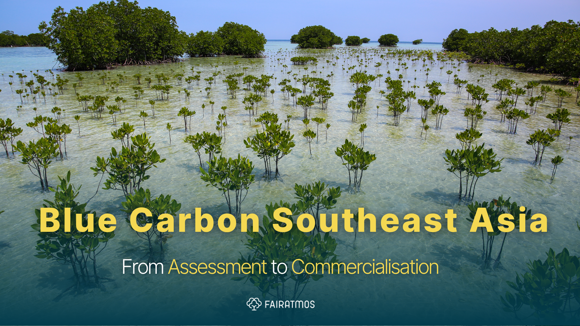
Jakarta, 11 May 2026. Southeast Asia holds roughly a third ofthe world's mangroves. Less than 2% ofits coastal ecosystems have been formally assessed for carbon credit potential.
The opportunity isn't missing. The feasibility data is.
For NGOs working in coastal conservation and asset managers building nature-based portfolios, this gap is the defining bottleneck ofthe blue carbon market in the region. Projects stall — not from lack ofinterest or funding intent, but because no one has run the numbers on whether a site is viable before capital is committed.
This article covers what blue carbon actually is, why Southeast Asia's pipeline is structurally underbuilt, what the assessment-to-commercialisation pathway looks like in practice, and how technology is compressing the timeline from site identification to verified credit issuance.
TL;DR: Southeast Asia's mangroves, seagrasses, and coastal wetlands represent one ofthe largest untapped blue carbon reserves on Earth. But most projects never move past the idea stage because credible feasibility data is absent at the pre-investment phase. FairAtmos's AtmosCheck gives NGOs and investors a structured, data-driven way to assess site viability — before committing capital, community agreements, or development resources.
Why Is Southeast Asia's Blue Carbon Pipeline Underbuilt?
The region has the assets. The pipeline is thin because feasibility has been treated as a development cost rather than an intelligence tool.
Blue carbon projects in Southeast Asia face a compounding problem at the earliest stage. Coastal ecosystems — mangroves, seagrass beds, tidal wetlands — are ecologically complex, legally sensitive (many overlap with ancestral domains or community fishing grounds), and require
site-specific data to model carbon sequestration rates accurately. Generic regional estimates don't satisfy Verra or Gold Standard verification requirements. And running a full feasibility study the traditional way — field surveys, baseline modeling, community consultations, regulatory mapping — costs time and money that most developers won't spend before they know whether a site is worth pursuing.
The result: most potential sites never get assessed. The ones that do move slowly. And the blue carbon market in the region remains a fraction ofwhat the underlying ecology could support.
What Makes Blue Carbon Different From Forest Carbon?
Blue carbon sequestration rates are not comparable to terrestrial forests — they are dramatically higher per hectare, and the permanence dynamics are fundamentally different.
Coastal ecosystems sequester carbon at rates 3–5 times higher than tropical forests on a per-hectare basis. More importantly, they store carbon in sediment layers that can persist for millennia — not just in above-ground biomass that is vulnerable to fire, pest, or drought. When a mangrove is cleared, that stored carbon is released rapidly. When it is restored, sequestration resumes and accelerates over time.
This combination — high sequestration rate, long-term storage, measurable additionality — makes blue carbon one ofthe most scientifically defensible categories in the voluntary carbon market. International buyers, particularly those under pressure to demonstrate co-benefit quality, are increasingly prioritizing blue carbon credits over generic forest offsets.
"Blue carbon credits with verified biodiversity and community co-benefits consistently command a 30–50% premium above standard forest carbon offsets in the voluntary market
— but only when the underlyingproject data is bankable."
What Does the Assessment-to-Commercialisation Pathway Look Like?
A credible blue carbon project moves through four stages: feasibility, development, monitoring, and commercialisation. Each stage has specific data requirements and decision gates.
Stage 1 — Feasibility (AtmosCheck) Site identification, carbon stock assessment, regulatory mapping (ancestral domain status, coastal zone classifications, national registry requirements), preliminary baseline modeling, and community landscape mapping. This is the stage where most projects die — or should never have started. Getting this right early eliminates wasted capital downstream.
Stage 2 — Development (AtmosDev) Full feasibility study, project design document (PDD), FPIC process with coastal communities, HCV (High Conservation Value) assessment, benefit-sharing structure design, and submission to verification standard (Verra VCS + CCB, Gold Standard). FairAtmos runs this stage with in-house certified HCV assessors and a proprietary dynamic baseline model — producing stronger additionality claims than static baseline methodologies.
Stage 3 — Monitoring (AtmosWatch) Ongoing MRV (Monitoring, Reporting, and Verification) using IoT-enabled biodiversity sensors, satellite remote sensing, and periodic field validation. Continuous monitoring is what keeps credits valid and what gives premium buyers the data transparency they require.
Stage 4 — Commercialisation (AtmosFund) Access to FairAtmos's verified buyer network — currently 10+ Letters of Intent and 4.1M+ tCO2e in pipeline potential. Credits with verified community co-benefits and biodiversity data enter a buyer pool that actively prices quality above spot market rates.
Why Does the Feasibility Stage Determine Everything Downstream?
Poor feasibility data doesn't just slow a project down — it invalidates it. Every downstream decision in a blue carbon project traces back to the quality ofthe initial site assessment.
A site assessment that misses ancestral domain boundaries creates FPIC problems at the development stage — sometimes after significant capital has been deployed. A baseline model that relies on regional averages rather than site-specific data produces additionality claims that fail verification. A community landscape map that doesn't account for active fishing grounds or cultural sites generates opposition that stalls construction.
This is not hypothetical. It describes the actual failure mode ofmost blue carbon projects that collapse between pre-feasibility and project registration in Southeast Asia.
AtmosCheck was built specifically to close this gap. The platform integrates environmental data layers — soil composition, tidal hydrology, species distribution, land tenure classification, regulatory zone mapping — with community intelligence and regulatory requirements across Indonesia, Malaysia, the Philippines, and Laos. The output is not a generic report. It is a site-specific assessment that answers the questions a project developer, an NGO partner, or an investment committee actually needs answered before committing to a project.
How to Start a Blue Carbon Feasibility Study
For NGOs and investors approaching a potential site for the first time, the sequence matters as much as the data.
1. Identify the site boundaries and land tenure status. Does the area overlap with ancestral domains, community fishing grounds, or protected coastal zones? This determines your FPIC obligations before anything else.
2. Run a preliminary carbon stock estimate. Mangrove density, species composition, and sediment depth are the primary variables. AtmosCheck aggregates these from existing satellite and field data layers without requiring a field team at this stage.
3. Map the regulatory environment. Indonesia's SRN registry, KLHK requirements, Philippine administrative orders, and Malaysian coastal zone legislation all have site-specific implications. Regulatory misalignment at this stage is the most common cause of project delays.
4. Assess community landscape. Who lives adjacent to or inside the site? What are their existing livelihood dependencies on the coastal ecosystem? Community mapping at feasibility stage is not a social obligation — it is a project risk assessment.
5. Model additionality. What is the credible counterfactual? What would happen to this ecosystem without the project? A dynamic baseline model — rather than a static regional average — produces a defensible additionality claim for verification.
6. Run the AtmosCheck assessment. Integrate all five inputs above into a structured feasibility output that maps carbon potential, regulatory readiness, community risk profile, and estimated credit volume. This is the document an investment committee or NGO board needs to make a go/no-go decision.
Conclusion: The Blue Carbon Opportunity Will Not Wait
Southeast Asia's coastal ecosystems are degrading faster than the carbon market is moving to protect them. Mangrove loss in the region runs at roughly 1% per year — each hectare lost releases decades ofstored carbon and eliminates the sequestration potential ofevery credit that site could have generated.
The assessment gap is solvable. The technology exists. The regulatory frameworks are maturing.
The buyer demand is real and growing.
What has been missing is a structured, scalable way to move from site identification to bankable feasibility data — fast enough to keep pace with ecosystem loss and investor timelines.
That is what AtmosCheck was built to deliver. And for NGOs and asset managers who are serious about blue carbon in Southeast Asia, it is the right place to start.
Ready to assess your site? Run a free blue carbon feasibility assessment at ATMOSCHECK— or explore FairAtmos's end-to-end project development pathway at fairatmos.com.
For Buyers & Investors
Explore verified, high-impact projects like this through AtmosFund & invest in the future of sustainable landscapes.
Explore AtmosFundFor Landowners & Project Starters
Learn how your land could qualify for carbon project development through AtmosCheck.
Sign Up Now