Preserve Nature, Restore Climate
High Quality Nature Based Solutions to Remove Emission From The Atmosphere

Developing a carbon project can be long, expensive, and meticulous
Fairatmos is here to help
Simplify your project development journey with technology
For Project Developers
For Corporate Buyers
For Carbon Investors
01
Assess Your Project
AtmosCheck
by
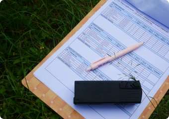
Simply upload your project area, obtain carbon project eligibility result 8x faster than conventional method, for free. Powered by AI & high-precision remote sensing technology.
Start a Project Now
02
Get Funding for Project
AtmosOffset
by
Get funding for your carbon project from trusted corporations or investment funds through our platform.
Explore More
03
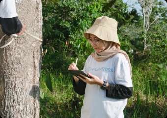
Monitor Your Project
AtmosWatch
by
Manage and monitor your project real time with high precision and generate reports that you need easily from our platform.
Book a Demo Now
04
Sell Your Carbon Credit
AtmosOffset
by
Sell carbon credits from your carbon projects easily by listing them in our platform.
Explore More
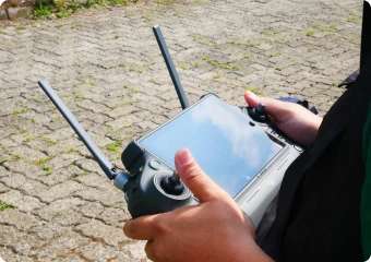
Delivering High-Integrity Carbon Projects with Technology
Fairatmos leads in utilizing advanced tech for top-tier carbon reduction.Our multidimensional approach, blending state-of-the-art monitoring and data-driven analytics, sets a new standard for eco-friendly initiatives.
View Our Tech
Your data is secure with us. Fairatmos is ISO 27001 Certified.
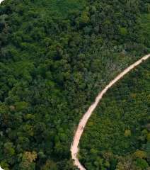
Fostering Innovation and Growth in Southeast Asia
Fairatmos is actively engaged in advancing the development of forest carbon projects within Southeast Asia, with aspirations to broaden its reach to additional nations in the immediate future.
Discovering Sustainable Solutions for Carbon Projects
Co-developed with
Cilacap Blue Carbon: Java's First Community-Based Blue Carbon Project
Central Java, Indonesia
Forestry
Upcoming
This blue carbon project is estimated to sequester 506,100 tCO2eq over the project's lifetime. Located within the vast Segara Anakan lagoon along Java Island's southern coast, the project area is threatened by unsustainable aquaculture practices and a lack of incentives to restore the mangrove ecosystem. The revitalization of the mangrove ecosystem is critical and closely linked to the communities' well-being, as they rely heavily on silvofishery for their livelihoods, which can only thrive in a healthy mangrove ecosystem.
See More
Co-developed with
Muara Teweh Conservation: Protecting one of the largest logging concession
Central Kalimantan, Indonesia
Forestry
Upcoming
The project aims to pivot logging forest into a protected forest, resulting in approximately 25 million VCUs. The forest area is dominated by secondary forests and emerging forests. The project has been actively harvesting timber in the past decade, with an >80% logging realization achievement against its management plan (RKU). The project area is bordered by palm oil plantations and illegal mining areas, creating a clear threat of illegal deforestation and encroachment. The project area is one of the top 10 largest and oldest concessions in Indonesia, with area 5x larger than the average logging concessions.
See More
Co-developed with
Laos Forest Conservation, Climate & Community Project (LFCCC)
Laos
Forestry
Upcoming
Project area spans over 300,000 Ha of degraded lands and lowland secondary forest in 5 National Reserves in Laos. Project has signed MoU with the government of Laos and given green light to be developed as a carbon offset project. It will focus to protect 80,000 hectares of pristine forest that is under threat of illegal deforestation activities and simultaneously restore more than 9,000 hectares of degraded land near the Laos National Forest. The project is expected to avoid and sequester approximately 231,979 tons of CO2e per year through forest protection and restoration activities. Preserving the project area will provide essential ecological services, particularly benefiting the local community. More than 65,152 individuals are affected by this project as they heavily rely on the forest for their livelihoods.
See More
Bujang Raba
Sumatra, Indonesia
Verified
This programme lowers unlawful poaching, forest fires, and unsustainable extraction of timber and non-timber forest products by involving local populations in safeguarding their forest.
See More
Sintang Tropical Initiative: Improved Forest Management in Kalimantan's Region
West Kalimantan, Indonesia
Forestry
Upcoming
The project produces an estimated 245,000 tCO2eq per annum through its conversion from logging to a protected forest. The project manages an IUPHHK-HA license until 2057. The asset owner is a seasoned logging company with 11+ years of experience and is currently actively logging the concession. The project is an active concession, reflected in the high deforestation rate over the past 10 years, where the area experienced an annual forest cover loss of 1.6%.
See More
The Nicaforest High Impact Reforestation Program
Nicaragua
Verified
Combining reforestation on degraded land for sustainable timber production, sequestration of CO2 and protection of native forests + animals.
See More
Gain Invaluable Knowledge through Exclusive Resources Access
Download our latest white paper with BCG today.
Trusted by Leading Partners Around the World


What they say about us
From reducing carbon footprints to fostering sustainability, discover how individuals and organizations alike are shaping a greener future.
"We are dedicated to supporting Indonesia's efforts in reducing carbon emissions and achieving our NDC target. Our collaboration with Fairatmos allows us to expand our impact through innovative projects focused on carbon emission reduction."

Dannif Danusaputro
CEO of Pertamina NRE
"The aim is to enhance the well-being of forest communities through sustainable development partnerships. However, accessing environmental services as a new funding source poses challenges. BNF's collaboration with Fairatmos has facilitated a deeper examination of available options."

Juliarta Bramansa Ottay
CEO of Borneo Nature Foundation Indonesia
Accompanying each steps you take for a greener action
Book a session with our experts today.
Schedule a call
Get In Touch
Take the first step towards a green revolution. Complete the form and be a catalyst for positive environmental change. Join us now!